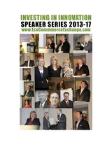
INVESTING in INNOVATION for SMART GROWTH


Speaker Series


GEOSPATIAL INFORMATION SYSTEMS (GIS)


The SMART Speaker Series in association with SMART Community Exchange (SCE) and Eco Commerce Exchange (ECE) is now in production. From live events and select local venues, to an on-line presence that enables the worlds of social media and live performance to seamlessly meet, the ECE experience is about collaborative learning, discovering new business opportunities and unique contacts.The ECE is always open and just waiting to be discovered. 


CALL FOR SPEAKERS


Speakers


The Speakers have at least one thing in common - they share insight, provoke thought and stimulate conversation about compelling and timely issues, stories and events. By offering entertaining educational opportunities that are unique and unavailable elsewhere, ECE continues to attract expert Speakers from around the world. 


The first Speaker Series in 2013 featured a number of highly regarded experts in the field of Eco Commerce. The lecture program has since expanded to include internationally renowned business executives, investors, entrepreneurs, policy makers, philanthropists, scientists, authors, media experts and other luminaries.


The Eco Commerce Exchange (ECE) has become a well-established and highly regarded highlight of the global commerce, and an integral part of the international business community. 


For topic suggestions, speaker engagements, and sponsorships:

Partner@EcoCommerceExchange.com


International Audience


The ECE works closely with organizations around the planet to identify Speakers who have particular appeal for ECE's fast growing international audience of over 2 million business executives, values-based investors and donors, entrepreneurs, and policy leaders. 


Public Service 


The Speaker Series also addresses an important role of ECE's global mission - public service in the communities - by dedicating speakers to address education and other societal issues and concerns.


All production expenses for the Speaker Series are covered by sponsorships. NO state funds, research foundation funds, donations or general gifts are used to fund or support the Speakers or programs.


Public Private Partnerships (PPP)


We help business executives, investors, and philanthropists seeking potential partnerships to find projects and engage investors with enterprises, organizations and communities around partner projects by region. 


Collaborative Online Learning 


This speaker series is about bringing best practices to market. ECE brings together individuals and organizations in a way that does not require a large investment of funds and time. By pooling our contacts and resources, we can find new opportunities to bring innovations to market in a quick and efficient manner. Together, we can overcome market penetration challenges and remove barriers accelerating access to markets, funding and government approval process.


This Speaker Series will discuss the following:

GIS technology has broad applications in the natural and social sciences, humanities, environmental studies, engineering, and management. Examples include wildlife habitat study, urban and regional planning, contagious disease monitoring, agriculture and forestry, environmental quality assessment, emergency management, transportation planning, and consumer and competitor analysis. 


We develop new geographic, technological, and cartographic concepts required to produce informative, meaningful maps that illustrate geographic phenomena. By using a combination of Internet and desktop geographic information softwares,  we perform geocoding, thematic mapping, web map mashing, and spatial analysis. Maps are generated from publicly available published and crowd-sourced data sets, and individual geographic data sets created from scratch. 


The essential skills of spatial data management, analysis, and visualization is to gain hands-on know-how in spatial data collection, editing, transformation, and mapping, as well as spatial analysis operations such as location-based query, address geocoding, terrain and watershed analysis, spatial interpolation, best site selection, least cost path delineation, and a number of other GIS modeling techniques. 


GIS can help investors, business and policy leaders get a clear idea of the potential of a given site, the overall market and its future potential. By using the latest GIS we can create a new model for future climate finance initiatives. We aim to decrease the cost of feasibility investigations, provide transparency and accelerate the regulatory and investment decisions in Eco Commerce projects.


New GIS software can assist in analysis, planning and policy formulation providing a multi-layered and useful picture for both policymakers and potential investors. GIS can generate realistic cost-benefit projections for different financial incentives and energy development policies, and this will in turn help local decision makers. 


GIS delivers information on weather patterns, sunshine, rainfall and combined this with other existing data sets on electricity grid lines, road network, topography, population density, and land use patterns provided by Energy Commissions, Meteorological Service Agencies, and Forestry Commissions. Data can be incorporated into an integrated GIS tool that can create and print detailed maps of a given area, overlay color schemes, create different business and policy scenarios, and calculate the resulting costs, energy generation and emissions effects. Such programs offer the potential for scaling up as climate change mitigation actions.


Submit Initiative/Project


read more


Submit TSF


read more


ICT


read more


'Coming together is a beginning ✪ Keeping together is progress ✪ Working together is success', Henry Ford.


Chamber of Eco Commerce

All Rights Reserved 2010


Atlanta ✪  Washington DC ✪ New York City ✪ London ✪ Helsinki ✪ Beijing ✪ Moscow